Pony Express to Wendover
Click on the trail name to download the GPS file, or the image to enlarge the map
Travel Time & Difficulty:
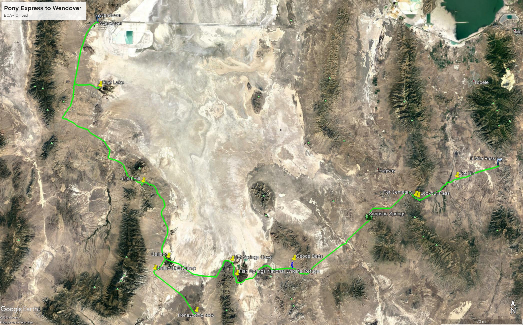
Plan on at least 5 hours to run the trail at a moderate pace, not including travel time to and from the trail head and not including time spent at stops. Add 1 hour additional travel time for optional Honeycomb rock side trip, 40 minutes for the geode beds, and 40 minutes for Blue Lake. Route can be ran either direction. The GPS track itself is roughly 250 miles so plan your fuel needs accordingly.
Most of the trail is a mild dirt road that can become fairly washboarded in spots. A few moderately rocky sections on your way to the geode beds will slow you down but aren't difficult. Trail can be ran in a stock 4x4 vehicle, or OHV.
OHV users be aware this GPS route is completely open to OHVs, however the Fish Springs National Wildlife Refuge does not allow OHV's to travel into the reserve itself besides on the county road.
Trail Description:
This route covers most of the Pony Express National Backcountry Byway , and connects it with Wendover.
Stops along the way include Lookout pass, a pet cemetery, Simpson Springs, Dugway Geode beds, Fish Springs National Wildlife Refuge, Hot Springs Cave, Callao, Callao CCC Camp, Honeycomb Rock, Gold Hill, and Blue Lake. The route also has many additional pony express stops along the way that are not listed, among many other sites along the way. For those who are certified, Blue Lake is a popular scuba diving spot in addition to its scenic value.

